

This page has been automatically translated. Please refer to the page in French if needed.
Climatic hazards
Drought-related cracks: new help to better protect homes
Publié le 03 juin 2026 - Mise à jour le 08 juillet 2026 - Public Service / (Prime Minister)
The alternating periods of drought and rain generate, on clay soils, ground movements that cause cracks on buildings: it is the shrinkage-swelling of clays. A new zoning has been in place since 1er July and the eligibility for the prevention fund created by the State is relaxed.
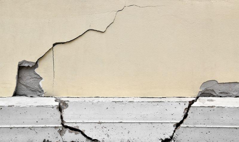
Faced with repeated periods of drought, many homes are exposed to ground movements that can cause cracks. To help homeowners protect their homes before the damage becomes too great, the State continues its preventive action through the clay prevention fund.
How to access the clay prevention fund?
Since October 2025, a new prevention aid (the clay prevention fund) is tested by the State in 11 prefigurative departments: Allier, Alpes-de-Haute-Provence, Dordogne, Gers, Indre, Lot-et-Garonne, Meurthe-et-Moselle, Nord, Puy-de-Dôme, Tarn and Tarn-et-Garonne.
This system allows owner-occupiers of single-family homes located in areas of high exposure to the AGR to benefit, under resource conditions, from subsidies to finance vulnerability diagnostics and preventive works.
An order of 23 April 2026 broadens the scope of experimentation to more households. Entered into force since 1er may 2026, the text provides for these flexibilities:
- eligible homes must now count to the maximum 3 levels (basement and attic are considered levels), compared to 2 levels previously;
- study phase: even if your home is cracked, you can benefit from the help dedicated to vulnerability diagnosis (there are no more crack-related conditions) ;
- works phase: for the aid dedicated to this phase, the maximum crack width condition changes to 5 mm (instead of 1 mm).
FYI
You can use the simulator (updated with the new zoning) to check your eligibility using: Clay prevention fund eligibility simulator.
A new zoning for the RGA exhibition since July 1, 2026
To accommodate the high loss rate recorded in recent years, a new IGS exposure zoning has been in place since 1er July 2026 (order of 9 january 2026).
The new map shows an increase in medium and high exposure areas, which now represent 55% of the territory (compared to 48% in 2020). 12.1 million existing detached houses are concerned (or 61.5% of detached houses).
This new zoning also applies to: promises of sale or authentic deeds of sale of unbuilt land buildable; contracts for construction of single-family homes.
Reminder
Surface clay soils may vary in volume as a result of changes in their water content, due to weather conditions. They retract during periods of drought (phenomenon of « withdrawal ») and swell when the rains return (phenomenon of « swelling »). These variations are slow but they can reach a large enough amplitude to damage the buildings located on these grounds.
To learn more, consult the file on the removal-swelling of clays on the site Georisques.
Additional topics
Ministry for the Environment
Agenda
À partir du 1 nov. 2026
Énergie
Publié le 12 octobre 2026
Jusqu'au 23 oct. 2026
Vie scolaire
Publié le 09 octobre 2026
À partir du 1 nov. 2026
Arrêt de travail
Publié le 08 octobre 2026
Du 15 oct. au 20 oct. 2026
Impôts locaux
Publié le 22 septembre 2026